


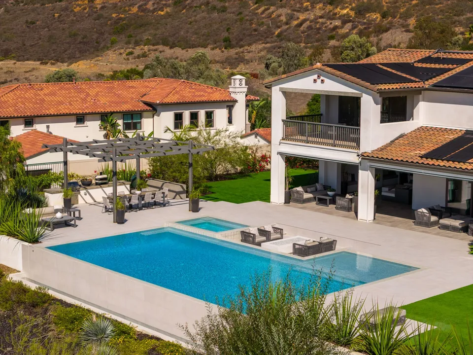
The lot
How much land comes with the home, and how the house, the yard and the pool sit on it.
From Santaluz Residence
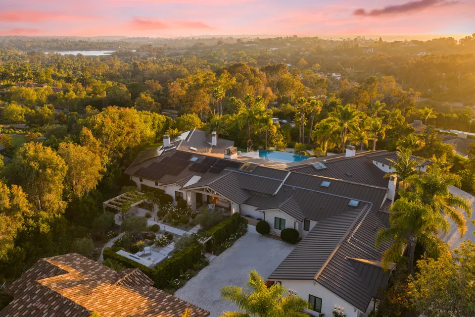
Residential
Every listing package includes drone photos, flown by our FAA Part 107 certified pilots. From above, buyers see the lot, the setting and how far the home is from the beach, the golf course or the village. We check the airspace for every address as soon as you book.
Photos from above show what a camera on the ground can’t: the whole property and what surrounds it. These come from recent listings.
How much land comes with the home, and how the house, the yard and the pool sit on it.
From Santaluz Residence
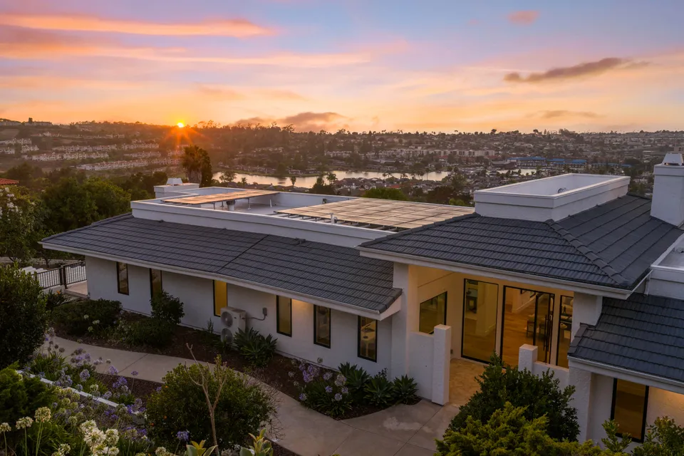
The shape of the roof and what is on it, such as solar panels or a roof deck.
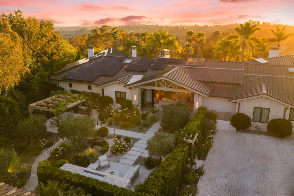
The trees, hills or water around the home, and the view it looks out on.
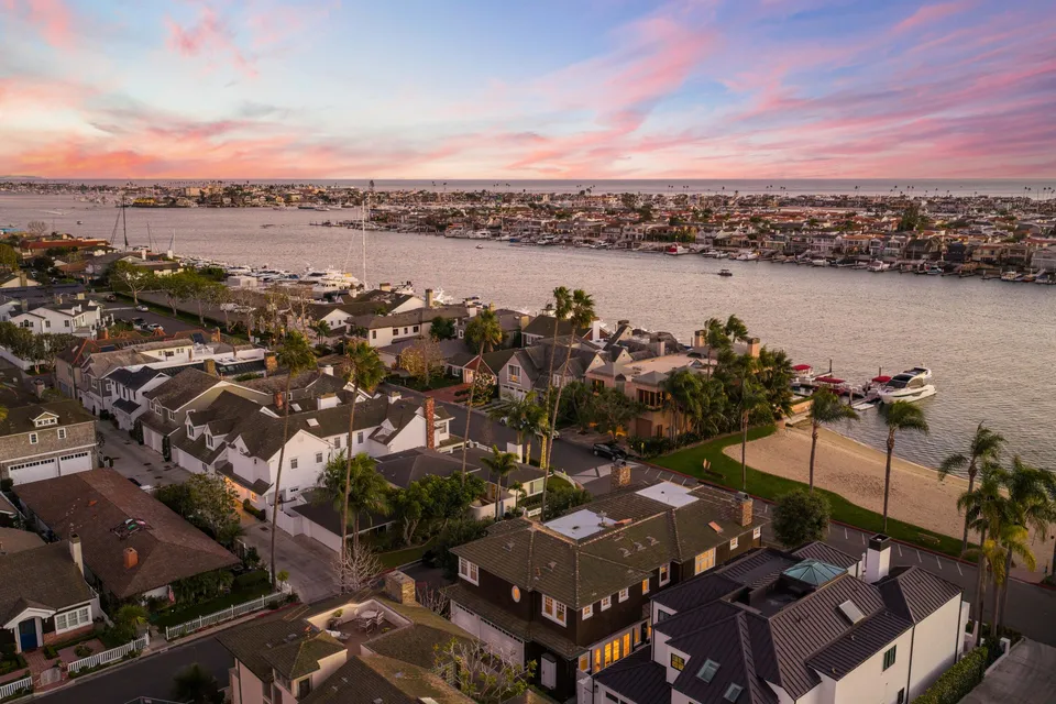
How far the home is from the beach, a golf course, open space or the village.
Cinematic and Luxury videos always include aerial clips when the airspace allows a flight, so the video shows where the home sits as well as its rooms.
The four kinds of videoWe check every address when the booking comes in, not in the days before the shoot. Most addresses need nothing more.
Choose a package and a date in the booking portal. Drone photos come with every package.
Book online
As soon as the booking comes in, we look up the address on the FAA’s airspace maps and check the city’s drone rules.
As soon as you book
If the flight needs FAA authorization or a city permit, we request it right away, since some approvals take weeks.
Only when needed
If the address needs more notice, or the drone can’t fly there, we tell you right away. Then we plan the exterior photos from the ground, an upper floor or a roof deck.
Before the shoot day
Most addresses need nothing beyond the usual booking. When one of these applies, we tell you what it means for the shoot.
Near an airport, the FAA can approve a flight automatically, up to a set height.
Where that height is zero, or a view needs to go higher, the FAA reviews the request by hand. It is filed at least 72 hours ahead, can take weeks and can be refused.
Del Mar and Laguna Beach require their own permit. Del Mar’s is filed by noon, five working days ahead.
Drones can’t fly over military bases, and a few places beside them, such as Cyprus Shores in San Clemente, need the base’s permission, which may not be given.
Many parks and beaches ban drones, such as Doheny State Beach and the city parks in Dana Point, so we launch from the property.
Most addresses need nothing extra. In these areas, a flight needs more notice, a permit or a launch from the property. Each town page has more.
Bressi Ranch, and parts of Aviara, Calavera Hills and Robertson Ranch
Close to Palomar Airport, the FAA approves little or nothing automatically, so the flight needs a request reviewed by hand, filed at least 72 hours ahead. Most of the rest of the city gets automatic approval up to a set height, or needs none.
Point Loma, Mission Hills, North Park, Kensington and downtown
San Diego International and NAS North Island control most of this airspace. Across most of Point Loma, any flight needs a request reviewed by hand. Elsewhere in the center, automatic approval covers only a low flight, and some streets need a request too. From an hour before to an hour after Padres and SDSU football games, drones can’t fly near Petco Park or Snapdragon Stadium.
MCAS Miramar’s airspace covers the community, so every flight needs FAA authorization first. In parts of it, that means a request reviewed by hand, filed at least 72 hours ahead.
The harbor, the Back Bay and most of Corona del Mar
This is John Wayne Airport’s airspace. Automatic approval stops at a set height, lowest near the Back Bay, and Santa Ana Heights needs a request reviewed by hand.
North of the San Luis Rey River, and Ocean Hills
Camp Pendleton’s airfield controls the airspace north of the river, and homes along the base fence need a request reviewed by hand. Ocean Hills is under Palomar Airport, where automatic approval stops low, so higher views need a request filed at least 72 hours ahead.
Inside the city limits
No FAA authorization is needed, but the city requires its own permit for every commercial drone flight. The application is due by noon, five working days before the shoot.
Inside the city limits
No FAA authorization is needed here, but commercial drone photos and video need a city permit. Book early so we can confirm it with the city.
Cyprus Shores, and the rest of the city
Cyprus Shores is inside Camp Pendleton’s restricted airspace, so flying there takes the base’s permission, which may not be given. Across the city, a flight needs the owner’s written consent and ends 30 minutes before sunset, and the drone stays 500 feet from the pier buildings.
City parks, the Headlands and Doheny
No FAA authorization is needed, but the city’s parks, Doheny State Beach and the Headlands open spaces are off limits to drones, so we take off from the property.
This page leaves out the FAA’s exact heights, since its maps change every 56 days. Your address is checked against the current maps when you book.
Anything else, call 760-585-9999.
Drone photos are. Spotlight, Professional and Luxury all include them. Cinematic and Luxury videos always include aerial clips when the airspace allows, and the proposed Estate package lists aerial video.
At least 48 hours ahead covers most addresses. Some need longer: a request the FAA reviews by hand goes in at least 72 hours ahead and can take weeks, and Del Mar’s permit has to be filed five working days ahead. We check your address when you book and tell you right away if it needs more time.
You hear from us before the shoot, and we plan the exterior photos from the ground, an upper floor or a roof deck instead.
No, not for a listing shoot. San Clemente is the one exception we know of: its city code requires the property owner’s written consent before a drone flight there. Gated communities and associations can also have their own drone rules, so let us know about them when you book.
The drone takes off from the listing, and the photos are taken from above it, looking out toward the view and the neighborhood. San Clemente’s rules bar flying over other private property without that owner’s written consent, and San Clemente and Del Mar both keep drones 25 feet from people.
Yes. We fly the drone at twilight wherever the airspace allows. San Clemente is the exception: its city rules end drone flights 30 minutes before sunset, so we fly there earlier in the day.
Choose a package and a date in the booking portal. We check the airspace for the address as soon as the booking comes in.